A photo a day from Oriental, NC, the surrounding Pamlico County area, and nearby rivers, creeks, bays and other waterways of coastal North Carolina.


Oriental Daily Photo is a member of the City Daily Photo blog network.
See daily photos of other towns and cities around the world at:
CDPB Logo

Friday, October 31, 2008

10.31- Cormarant at Pecan Grove channel

A cormorant dries it's wings in the setting sun

I went out sailing in the Bauer dinghy this afternoon, and passed this cormorant standing atop one of the private markers leading into Pecan Grove Marina from Oriental Harbor as I returned near sunset.

You can see the masts of boats in Pecan Grove Marina in the background... the Marina recently just about doubled it's slip capacity by digging out an extension to it's lagoon. Plenty of new slips left, but they are beginning to fill up.

-30-

Thursday, October 30, 2008

10.30- Bayboro Airport


A lone small airplane sheltered in the hanger of the Bayboro Airport


While I was in the Pamlico County seat of Bayboro today, I decided to cruise by the "Bayboro Airport" I had noticed on my road map.

The airport consists of an empty stretch of grass amongst farmland, a single airplane hanger, a windsock, a dilapidated shed, and several apparently-abandoned-vehicles:


Behind the hanger rests this moribund hobbyist's hanger for the "Down'n the County Radio Control Flyers:"


Call early to reserve your flight!


-30-

Wednesday, October 29, 2008

10.29- Foreign Yacht


Yacht cruising down ICW between Garbacon Shoals and Whittaker Creek on the Neuse River
(click on picture or here for full size)

I'm guessing this is about a 100 foot (or more) yacht, cruising at full throttle down the ICW as it passes by Oriental in the Neuse River... probably headed for Beaufort, where these big guys like to tie up.

The yacht is flying a foreign flag off the stern (with a "courtesy" small U.S. flag flying amidships)...

I have looked through some on-line flag directories, and all I can guess is that it is the flag of the Marshall Islands.

If you can identify the flag, please drop me an comment/ahoy at the end of this post... You can click on the picture above for a full size view.

Whittaker Creek marker No. 2 is on the right side of the picture, while a sailboat just visible on the left heads towards Whittaker Creek.


-30-

Monday, October 27, 2008

10.26- Harbor full

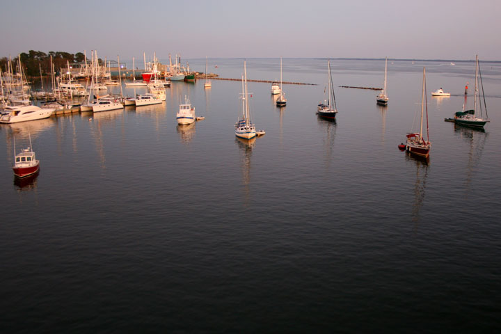
Boats anchored in Oriental Harbor after sunset

There were a total of 17 boats at anchor in Oriental harbor tonight as the sun set. Mostly sailboats, but a few trawlers.

Town Dock and many transient slips at the marinas were also full.

Many of these boats are "snow-birds" heading south on their winter cruises. A few are probably boats that have been parked up north during hurricane season for insurance purposes... Hurricane season ends on November 1, and boats will then begin moving en masse along the Intracoastal Waterway past Oriental as they move back south of the North Carolina/South Carolina border, where insurance policies often do not cover risks during the season.

Here is another view of the harbor, looking back towards the Oriental Harbor Marina and the Point Pride Seafood docks:

-30-

Wednesday, October 22, 2008

10.22- Garbacon Shoal Marker


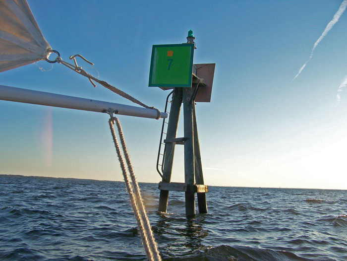
Neuse River Marker No. 7, a.k.a. Garbacon Shoal Marker,
as seen from the Bauer 10 dinghy.

Today I sailed the Bauer 10 out to Oriental Marker No. 1 to try to get some pictures of the weekly Wednesday night sailboat race. Only three sailboats showed up, so I didn't get any impressive shots (I was hoping for more boats).

As the boats sailed off for the first mark on the informal race course, I decided to follow along for a while. I saw the boats rounding the first mark (Garbacon Shoal) and decided to go at least that far.

This is the farthest I have sailed the dinghy out on the river, so as I rounded the marker I snapped this picture for proof/commemoration.

In the foreground you see the boom, the tack of the mainsail and the mainsheet. The whispy threads you see flowing from the mainsail act as my anemometer and tell-tails.

As I reached Garbacon Marker, the three racers were approaching the Adams Creek Marker a few miles downwind. The sun was nearing the horizon, so I decided one leg of the race was enough for me.

As I sailed back, the sun set and the wind died... I mounted my navigational lights and slowly sailed back as the temperature began falling considerably. Fortunately I brought some layers to put on.

The whole round trip - slip to Garbacon and back to slip - was just under 6 statute miles, and I covered it in about one hour and forty minutes... not bad considering the wind died off so much on the way back.

My route today is shown by the red line on the map below...

the yellow line is the approximate route of the Wednesday evening races (about 8.25 stat. miles):

View Larger Map

Tuesday, October 21, 2008

10.21- Cranky Grannies vote, too!


Just a reminder that "One-Stop" EARLY VOTING HAS BEGUN here in North Carolina.

I will be working the Oriental precinct polling location on November 4, election day, but hopefully everyone will have voted by then.

So far, almost 17% of the approximately 6,000 registered voters now living in Pamlico County have voted!

At poll-worker training last night we were told to expect plenty of E-day voters, however... looks like this won't be your standard less-than-50%-turnout kind of election.

REMEMBER VOTERS:

MARKING THE "STRAIGHT TICKET" CHOICE ON YOUR BALLOT
WILL NOT RESULT IN A VOTE FOR PRESIDENT!!!

YOU MUST VOTE A CHOICE IN THE PRESIDENTIAL SELECTION ON YOUR BALLOT for your vote to count in the Presidential race ...you can then ALSO select a "straight ticket" for North Carolina state candidates if you wish, but make sure you vote separately in the Presidential choice on your ballot.

This is true WHETHER YOU VOTE ON A MACHINE OR USE A PAPER BALLOT.

(Write your NC state legislators if you think that is screwy... It is so by NC statute, and only the legislature can change it)

Also, if you wish to vote for JUDICIAL CANDIDATES, they WILL NOT BE INCLUDED IN A STRAIGHT TICKET VOTE, for the logical reason that judicial races are non-partisan in NC... since judges don't run by party affiliation, the straight party ticket selection will not affect these races.


Oh, and McCain supporters please remember that I have previously posted a picture of a McCain yard-sign, on October 3.
-30-

Monday, October 20, 2008

10.20- "Day's Landing"


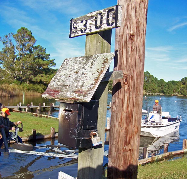
"Honor box" at the Days Landing boat ramp on Ball Creek.
Today I went out exploring the nearby Whortonsville and Florence areas of Pamlico County, looking for creek entrances for some possible kayaking.

I found these three camouflaged anglers taking their Carolina Skiff out at "Day's Landing" on Ball Creek, which runs into the Bay River near Florence.

Don't ask me why the anglers were all wearing camo... I cannot imagine that it fools any fish, and none of these guys had guns, so they weren't hunting... and anyway they have made no attempt to disguise their Carolina Skiff.


I will chalk it up to a general outdoorsman lifestyle, which I admittedly know little about except for an occasional trip to Bass Pro stores, where camo certainly appears in abundance.

This seems a good place to put in a kayak for a paddle around Ball Creek, Bonner Bay, Spring Creek and Long Creek.

... And from the looks of the sign, Day's Landing has not raised their ramp fee in some time!

Explore Ball Creek ("Day's Landing" is at the map marker), Bay River, Bonner Bay etc. on Google Maps:

View Larger Map

-30-

Sunday, October 19, 2008

10.19- Jib testing


Yours truly buzzing Lou-Mac Park while sailing on the Neuse River(Oriental Marker #1 in the background)

Today I went out to test the new jib foresail Capt. Dave and I rigged for the Bauer 10 Classic dinghy. I sailed out of the harbor to Oriental #1, then tacked up into the North wind to reach Lou-Mac Park. After buzzing the park I sailed out to Whittaker Creek markers #1 and #2, then back to the harbor.

Winds were in the 10-15 knot range, out of the North, so both the rig and myself got a good work-out. The jib has a number of issues to be solved... the most annoying is that when tacking, the sail tends to foul on the boom (which protrudes up to one foot forward of the mast) and the jib sheets keep getting tangled on the forest of cleats that now inhabit the lower mast.

Early indications are that the jib improves the dinghy's windward ability, but more testing is required to confirm. Still can't quite sail close-hauled, though.

I am confident that the Bauer is sailing faster on all points of sail with the added jib, the most noticeable difference being on beam reach and close reach.

The best thing so far about having a jib is that I can go "wing-and-wing" while running downwind... While running wing-and-wing today I hit a steady 4.0 + knots, maxing out at 4.5 knots! I have hit 4.7 knots before, with only the mainsail, but in heavier winds.

The mast is developing a pretty serious crack, and I don't know how much longer it'll last in winds like today's. Probably time to build a new mast, and re-think the running rigging.


-30-

Saturday, October 18, 2008

10.18- Green's Creek Challenge


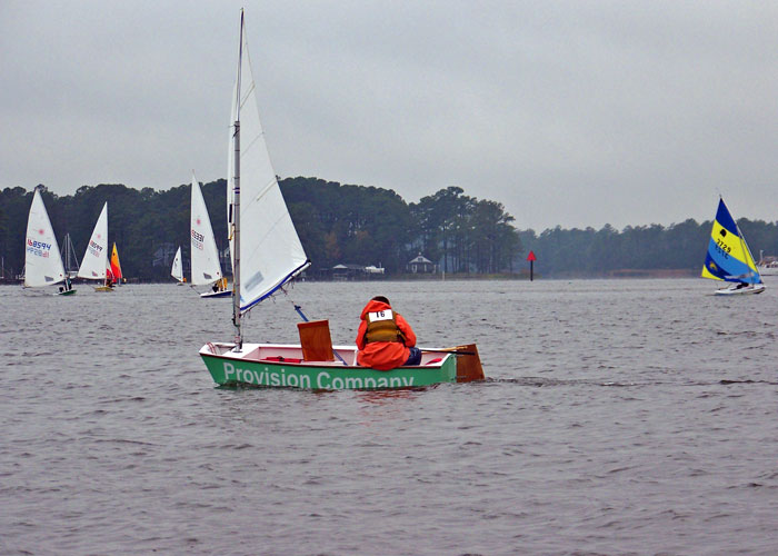
An Optimist dinghy heads down-wind towards the finish line in today's Green's Creek Challenge race, while Laser and Sunfish boats round Dewey point towards the Smith's Creek race marker.

A cool rainy day for today's Green's Creek Challenge, an annual sailboat race for boats under 20 feet sponsored by the Oriental Dinghy Club.

The race route began in Oriental Harbor, passed under the bridge, up Green's Creek, back down to Dewey Point, up Smith's Creek and back to the start.

The ODC had not posted results as of this writing.

I have posted additional pictures from the race on today's entry on The Dinghy Dock...

-30-

Thursday, October 16, 2008

10.16- "Skywatch Friday" - Sunrise and Moonrise


Sunrise over the Neuse River

Yesterday I was out boating before dawn... then again out boating after sunset. Two different trips.

The sunrise series above was taken from Captain Keith Bruno's Carolina Skiff as we headed down river to pull Capt. Bruno's gill-nets for fish.

You can meet Capt. Bruno, a really interesting guy, in Part One of my feature essay on Bruno, posted October 14 (scroll down to posting, or click here)... more of the essay is coming soon in Part Two...and maybe even Three.


Later on yesterday, I rowed across the glassy windless waters of river, in the Bauer 10, out to Oriental Marker No. 1, where the "Coriolanus" was drifting around for a Hunter's Moon watching party (see right). There was so little wind that even without an anchor, Coriolanus stayed within 50 yards of the same spot for about two hours.


Before I rowed out, I got the below picture of the moon rising over the river from the end of the Lou-Mac Fishing Pier.

Another dinghy-rower appears in the lower left, going into Whittaker Creek (you can tell it's Capt. Jesse by the bent oars!!)... the familiar Whittaker Point on the left... and a lone sailor trying to find wind on the right side of the picture:


While I was happy with the picture I got of the Oct. 14th Hunter's Moon, I was disapointed to have missed it coming up over the horizon... Then I learned from University of Texas' "Earth and Sky" that the Hunter's Moon was on the 14th AND the 15th, so I went out yesterday before moonrise and got the following series of the second night of the Hunter's Moon rising:


HAPPY SWF EVERYONE!
I look forward to seeing the other Skywatch pictures from around the world on the other SWF sites listed at:
-30-

Wednesday, October 15, 2008

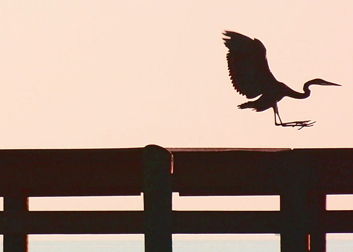
10.15- Great Blue Heron at sunset


A Great Blue Heron comes in for a landing on the Lou-Mac Park Fishing Pier as the sun sets and the Hunter's Moon prepares to rise.

I had planned on bringing you Part Two of "Endurance," a feature essay about Capt. Bruno (see prior post, below), today, but I have a bit more work to do on that one, so it's not quite ready yet.

Instead I am posting a picture I caught today - a Great Blue Heron that was hanging out on the Lou-Mac Fishing Pier.

The bird was very stoically and majestically perched on the pier when I arrived on the scene riding my bike down South Ave., so I pulled over at a discrete distance and pulled out the little Kodak.

I had taken a couple of OK pictures of him standing straight and tall on the pier, silhouetted against the southern sunset sky, but was still waiting for the perfect pose when a couple came walking past the pier with their dog, and my Heron flew away (most birds, even the intrepid seagulls, flee their roosts at the sight of even the smallest of dogs in the vicinity).

As I reviewed the few pics I had already taken, all of which were out of focus or badly exposed, I cursed the little dog and its' humans for disturbing my photo shoot...

I resigned myself to the missed shot, and sat down to read my current book ("The Rescue," Joseph Conrad) as the sunlight continued to fade... After a few paragraphs, I caught the Heron in the corner of my eye circling the pier, and grabbed the Kodak just in time for this landing.

Sorry little dog and humans for my hasty curses... I already have plenty of pictures of Herons standing up straight and tall, and thanks to y'all I caught this action shot! Thanks little dog.

"Endurance," the Capt. Bruno essay (see prior post, below) will continue... It should be up tomorrow, but I'm not yet sure, since I normally post my "Skywatch Friday" entry on Thursday afternoons (go figure)... but my planned SWF posting is related to Capt. Bruno, so I may continue the story tomorrow... If not, it will be on Friday... TUNE IN TO FIND OUT!
-30-

Tuesday, October 14, 2008

10.14- "Endurance" - PART ONE


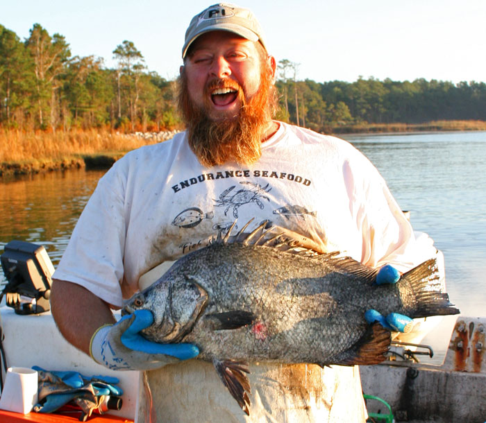
Captain Keith Bruno is pleased with this Atlantic Tripletail (Lobotes surinamensis) he pulled from one of his gill-nets along the Neuse River near Pierce Creek

Bruno, a commercial fisherman, does his own catching and his own retail selling of many fruits of the local waters... But after removing the rare Tripletail catch from his net, he proclaimed "you can't buy this one from me!"

Today and tomorrow, I will be bending the "City Daily Photo" rules to introduce you to Captain Bruno.

I hope you enjoy meeting him as I did...


Today I had the pleasure of accompanying Endurance Seafood owner Capt. Keith Bruno as he pulled his gill-nets set the previous night along the banks of the Neuse River and Smith's Creek. Bruno's prize catch of the day was the handsome Tripletail featured in today's photo.

Like not a few of Oriental's residents, Bruno has long experience working on water, and more than a few tales to tell about it...

From blood-curdling terror in the "Perfect Storm" of the North Atlantic to karmic respite along the sun-drenched beaches and ports of the Mediterranean... from a penniless vagabond sleeping under the docks of Bermuda to successful lobster baron... from cut-throat competition and anti-viral devastation of the New York lobster fishery to a happy family home in the welcoming world and diverse fisheries of Down East North Carolina...


Endurance:

  • en-dur-ance... n 1: PERMANENCE, DURATION 2: the ability to withstand hardship or adversity...
  • en-dure... vb 1: to undergo (as a hardship) especially without giving in...

Bred for Water:

Bruno, now 40, began his lifetime of working the waters as a 5 year-old, apprenticing with his father fishing lobsters out of Smithtown, N.Y., on Long Island Sound.

After high school, Capt. Bruno attended the Landing School of Boat Building & Design, where he built his project boat, the "Arab III," a mahogany 26' runabout... (You can see a very similar boat, the Miss Severn, by clicking here.)

From 1989 to 1991, Bruno worked on lobster boats, first working the inshore fishery, then moving up to the tougher world and better money of offshore lobstering.


The Perfect Storm:

In 1991, as a weakening hurricane Grace was working her way into the North Atlantic, the offshore lobster boat which was Bruno's workplace and home for 7 of every 10 days, began heading back to port.

Before making it back, however, the boat was overtaken by the infamous "Perfect Storm" of 1991 (the one that killed the captain and 5 crew of the Andrea Gail, as fictionalized in the George Clooney movie)...

As the lobster boat struggled through the heavy storm-torn seas, Bruno was on deck when the boat broached to in the trough of mountainous waves. Lying parallel to the waves in the trough, the boat was helpless as the towering following wave crashed on top of her. Bruno was crushed against the bulwark by the deck-load of lobster traps and tons of water enveloping the boat as the wave tore abrest.

Being so pinned down by the weight and pressure of the traps and water may well have saved Bruno from being immediately washed over the open transom or out of a scupper to certain death in the stormy seas, but Bruno's legs were injured and his body heat had been sucked out by the mass of chilly water that flooded his protective oilskin foul-weather gear.

As Bruno struggled to re-orient himself on the open deck of the still-broached vessel, a crewmate grabbed him by the collar, hauled him into the cabin, unceremoniously dumped him on the floor where he lay alone as the crewmate returned to the danger on deck.

Sometime later, perhaps an hour or so, Bruno regained his senses enough to begin removing the soaked clothing from his chilled and battered body in an attempt to begin raising his body temperature.

While Bruno struggled to remove his upper garments, the boat's Captain entered the cabin, saw Bruno moving and growled that it looked like he was ready to go back to work. When Bruno understandably indicated that indeed he was not so ready, the Captain expressed his great displeasure at the news, and added some comments to the effect that Bruno seemed to lack certain traits of male anatomy.

Again later, as Bruno continued to struggle removing his dangerously cold and wet clothing, and as he realized his legs had been so injured as to prevent him from walking, much less assisting the crew on the heaving deck in the storm, the Captain returned to ask Bruno if he was finished with his beauty rest and ready to return to the world of working men, only to be dissapointed again by Bruno's negative response.

The next day, the storm abated but Bruno still battered, the Captain again asked if Bruno were ready to go back to work. While Bruno understood and expected that the boat would not discontinue further lobster fishing to take his injured self back to port, he knew he was not able to return to the physical work of the crew.

The Captain informed Bruno that he would not rate any pay for the remaining days at sea, and that Bruno was welcome to return to crying like a girl in his berth until the boat returned to port.


The Shore of Refuge:

Back ashore and out of the lobstering business, Bruno began recovering from his injuries.

Bruno received a call from an old friend who asked him if he was available for work. Bruno explained that he was not fit for the work of commercial lobster fishing...

"But do you think you could sail?" he was asked. Bruno had sailed on a shooner one summer in his youth - just day-sailing, no cruising or ocean voyages, but Bruno knew the fundamentals of sailing.

"Sure, I can sail."

"Well, I need a boat delivered to Bermuda... I can offer you all your provisions for the trip, of course, and a return plane ticket plus a little pocket money... at least think about it."

Bruno thought about it, and two days later had consented to the job.

Bruno sailed the boat to Bermuda, still in pain and limited by his injury on the voyage. Upon his arrival, where he was required to stay aboard the fully-provisioned boat for a time, Bruno discovered his pain and injuries were nothing that all the rum in Bermuda couldn't cure.

When his pocket money ran out, Bruno cashed in his plane ticket. When vacated from the boat by the arrival of the boat's owner, Bruno's employer offered to loan Bruno money for a new plane ticket. Bruno decided not to accept the loan, and to stay in Bermuda.

Out of cash, with no family or friends and few acquaintances on the island, Bruno found serviceable accommodations underneath a dock on the beach...


TO BE CONTINUED...


-30-

Sunday, October 12, 2008

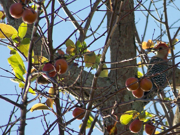
10.12- Red-bellied Woodpecker


Red-bellied woodpecker hunts for bugs in a Persimmon tree next to Oriental Harbor.
I heard a very noisy bird call as I was riding past the Dinghy Dock this afternoon (returning home from sailing in the Bauer 10)...

I stopped and listened until I finally spotted the source up in a Persimmon tree.

I got a few pictures of the bird, which I did not recognize, but suspected was a woodpecker due to its' behavior (pecking at the tree bark and pulling bugs out).

Back at home I found the bird, officially Melanerpes carolinus in one of my bird guides. The bird in today's picture is a male.

I'm not sure where the "carolinus" in the latin name comes from, but this bird's habitat extends across the U.S. from Atlantic Ocean into the Great Plains (excluding most of New England)...

It is a fairly common bird, but it is a brand new addition to my own life-list.
-30-

Saturday, October 11, 2008

10.11- Bay River fish-house


Shrimp boats rafting at Gaskill Seafood Co. docks in Bayboro.

Today I walked in the rain around the Gaskill Seafood Co. on the Bay River in Bayboro (county seat of Pamlico County).

Gaskill Seafood is a twelve mile trip up the Bay River from its' mouth on the Neuse River...

The Bay River is only a tad over 100 feet across where these 70 foot long trawlers are rafting.

Makes me wonder just how they turn around.

There were six trawlers in tied up at Gaskill today.

You can zoom in on the Gaskill Seafood Co. and explore the Bay River on the embedded Google Maps below, or Click here for full size Google Map ZOOMED IN ON GASKILL SEAFOOD:


Embedded with Map Channels.

-30-

Friday, October 10, 2008

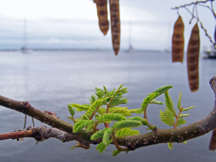
10.10- Rumors of Mimosa's hibernation are greatly exagerated (Skywatch Friday is prior posting, below)


A Mimosa tree near the Dinghy Dock is sprouting new leaves while seed pods from its' last cycle still hang from its' branches... Three "snow-bird" cruising sailboats lie at anchor in Oriental Harbor in the background.

My favorite reading tree, a Mimosa next to the Dinghy Dock on Oriental Harbor, is sprouting new leaves just about one month after it dropped its' last batch on going to seed. (See picture of same tree gone to seed in my posting of September 9)

I was afraid the tree had shut down for the winter... According to Wikipedia:

"In the Northern Hemisphere (the mimosa tree ) blossoms and produces fruit from November to June or July...In the Southern Hemisphere it blooms primarily from September to January."

Looks like this tree isn't sure which hemisphere it is in, so it is blooming twice just in case.

I'm glad of it, and look forward to the branches being full of leaves again... bare branches offer little shade, and shade makes for a better reading spot.

See more of my pictures of this same tree as it has gone through its' cycle this year:

-30-

Thursday, October 9, 2008

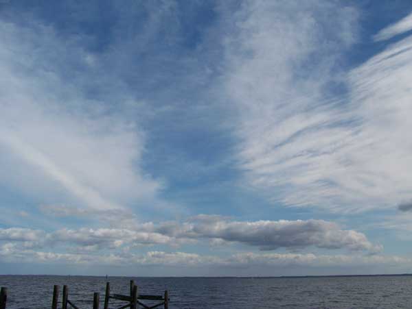
10.9- Skywatch Friday - Mixed sky

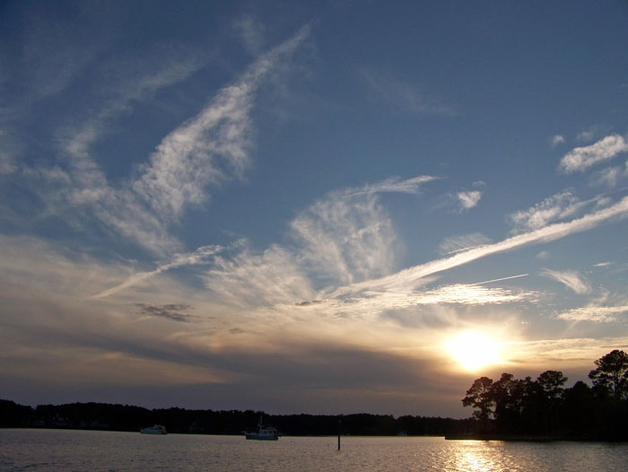
A mix of clouds fills the western sky over Green Creek
(Click on picture or here for full size)

Inspired by Dewdrop's recent Cloud Lessons on the Skywatch Friday site, I have been trying to learn my clouds, and taking a lot of pictures of clouds so I can study and compare them with pictures and descriptions in weather books and on-line.

As Dewdrop rightly pointed out, a sailor should know clouds, so I am slowly working through "Weather for the Mariner," by William J. Kotsch, Rear Admiral USN (Ret.), and refering to a couple of other weather-for-sailors books I have access to... unfortunately, they are all a bit dated, featuring black & white photos and lots of information on a (I assume) now moribund network of "telefacsimile"-transmitted isobar maps that seems to have been on the cutting edge of weather info sometime in the ancient past.

Today's main picture features a mixed sky, which I think includes cirrostratus, cirrus, altocumulus and/or cirrocululus (I can't quite tell the difference between those two), a tad of fractostratus, and some condensation trails.


I think... The hardest part for me right now is determining the altitude of the clouds I see, both in absolute terms and in relation to other clouds. I am hoping it is just a matter of looking at the skies a bit more (SWF has prompted me to do that) and to patiently do my homework on clouds and weather systems (as noted earlier, Dewdrop has inspired me to do that.)


I am still using the books to decode todays pictures, (taken yesterday), and am watching the shifting fronts and pressure systems on NOAA and WeatherUnderground to get a sense of why the sky filled with so many different types of clouds yesterday after several days of pure blue sky.


I would love to hear comments from the SWF community about the types of clouds in today's pictures.

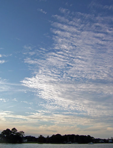
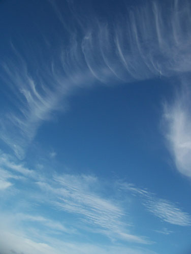
Here are a few more cloud pictures, also taken yesterday:

#2) More mixed clouds, this time facing East over the Neuse River:


#3) Altocumulus or Cirrocumulus ??? (facing just north of west):


#4) Straight above... condensation trail becoming cirrus ???


I look forward to seeing the other Skywatch pictures from around the world on the other SWF sites listed at:

-30-

Wednesday, October 8, 2008

10.8- Breakwater perch #2 - Heron edition


A Blue Heron surveys Oriental Harbor from its' perch at the end of the Oriental Harbor breakwater.

Okay, this is becoming a series: birds perched on the breakwater... see the very
similar photo of a Brown Pelican perched in pretty much the same spot in my posting of Oct. 1.

As in the Oct. 1 photo, I took this from about 15 to 20 feet away from the bird while sailing the Bauer dinghy back into the harbor after a brief sail out to Oriental marker #1.

-30-

Tuesday, October 7, 2008

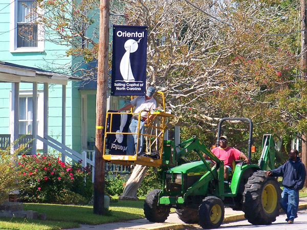
10.7- Where are we again?

Town workers erect new banners - promoting Oriental as the Sailing Capitol of North Carolina - On Hodges Street

These banners promoting Oriental have been appearing at various strategic locations around town over the past couple of months.

Today a bunch more went up along Broad Street and Hodges Street, the main thoroughfares through town.

Apparently the Tourism Board found a good deal on the banners... I've noticed similar banners in other towns and cities. Must be something of a trend.

The crew was having a great time putting these signs up... the guy actually installing the signs was putting on a one-man show, cracking up the "ground crew" the entire time they were working their way down Hodges.

I think the signs look nice, with an attractive sailboat & gull motif, but I am getting a little worried about the explosion of Oriental's self-promotion signs that have sprouted up all summer long.

The Oriental History Museum has also been erecting "historical markers" around town also.

It's beginning to make me feel like I'm living in some sort of museum, with all the promotional vertical banners and the explanatory placards at every turn, just like the Smithsonian museums. Well, more about that later.

-30-

Sunday, October 5, 2008

10.5- Air supply


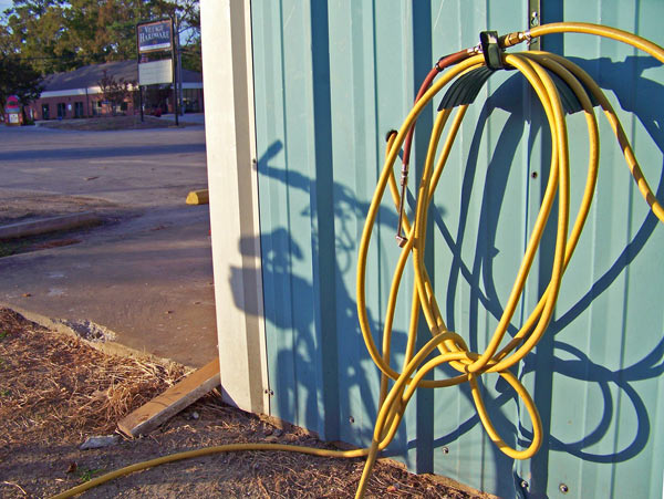
Compressed air hose at Village Hardware

Village Hardware, on Broad Street (Hwy. 55) is a great place for such things as nuts, bolts, mosquito control, mulch and boat parts.

Not everyone may know that it is also the place to go to fill your tires with air. Even when the store is closed.

An air hose protrudes from the south side of the building, ready for all your low-tire issues, free of cost. I suggest you bring your own pressure gauge, however, since the built-in one seems to be off by about 10 psi (they always are).

-30-

Saturday, October 4, 2008

10.4- Slow Solos

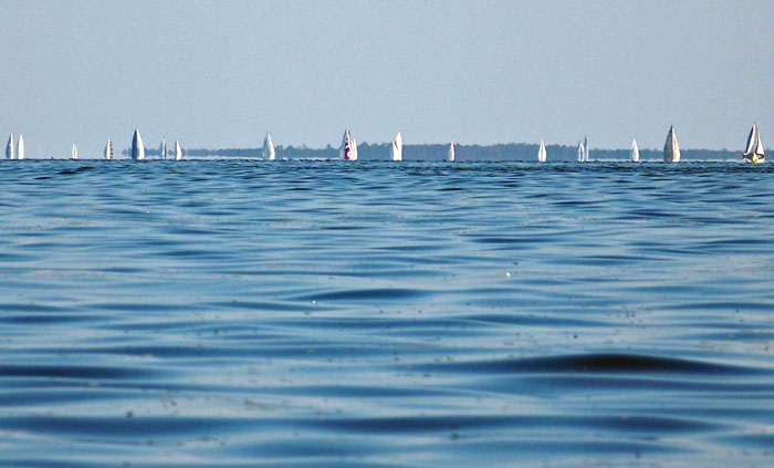
A number of sailboats in today's annual Neuse Solo Race were "wing-and-wing" in what passed for the "down-wind" leg of the race between the Garbacon Shoal marker and the Adam's Creek marker on the Neuse River.

(Click on picture or here for full size)

Solo sailors in today's Neuse Solo Race might've wished they had someone else on board to complain to about the lack of wind during most of the race.

I overheard a number of gripes from the fleet over the VHF while I too was attempting to sail on the Neuse.

One complainant broadcast that he was cruising at all of 0.3 knots... another captain responded he wished he had that kind of speed.

A number of captains repeatedly complained about the wakes from one chase boat interfering with what little momentum their sailboats achieved.

As the race time ran down with no boats nearing the finish, an increasing stream of captains well back in the pack called in to report they were abandoning the race... no doubt interested in getting back to the Tiki-Bar for post-race festivities.

The Committee Boat let it be known that the race would be called at 5:00 pm and finishing order would be based on the boats' positions at that time. No word yet on the winners.

The boats in today's photo are headed roughly towards the camera position, and appear "hull-down"... their hulls are not visible. The boats are about 3 to 4 miles away, the camera is only about one foot above the surface of the river, and the hulls of the boats probably stick up about four or five feet above the water... so the earth's curvature can account for some of the invisibility

... The BIG factor, however, is the REFRACTION OF LIGHT, creating an INFERIOR MIRAGE (the same thing that creates apparent "water" or "oil slick" near the horizon on highways or deserts).

The refraction caused as the light travels from cooler air to warmer air near the surface causes the light to curve away from the earth. Result is that you can't see what is actually in front of you, but you can see two of what is above you... the top "right-side-up" image of the tops of the sails is light traveling directly from the sails into the camera (or eye) while the bottom "upside-down" images are caused by light from the same objects traveling in a concave curve, first down toward the earth then back up and again into the camera (or eye). The light from the lower masts, trees and sails never reaches the camera, since it is also curving down towards the earth and then away from the earth and above the camera.

Click on the full size photo and you can really see the effect of refraction on the boats on the right side of the picture... You can see where the upright sails and trees of the shoreline meet what appears to be their reflection extending upside down from the bottom. This is a common optical illusion on the water: it makes distant shorelines, boats and other objects on the surface appear closer than they actually are (contrary to side-view mirrors on cars) because the refracted image makes it appear about twice as large.
-30-

Friday, October 3, 2008

10.3- Overlapping seasons

Signs in front of a Main Street residence indicate that shrimp season is now running into election season.
Fresh shrimp and candidates for elective office get equal billing in Ponce's yard.

While the message is clear on the Presidential ticket, the signs suggest possible household disagreement on the race for North Carolina House District 3; Norman Sanderson (R) is running against incumbent Alice Underhill (D) for the seat.

At least everyone can agree on the shrimp...

-30-

Wednesday, October 1, 2008

10.1- Breakwater perch

A Brown Pelican surveys the Neuse River from its' perch at the end of the Oriental Harbor breakwater

I photographed this brown pelican (one of my favorite subjects) from about twenty feet away as I was sailing around the breakwater in the Bauer dinghy.

Usually birds perching on the breakwater fly away as I sail closer, but this one stayed put, keeping one eye on me and the other on the river.

-30-