A photo a day from Oriental, NC, the surrounding Pamlico County area, and nearby rivers, creeks, bays and other waterways of coastal North Carolina.


Oriental Daily Photo is a member of the City Daily Photo blog network.
See daily photos of other towns and cities around the world at:
CDPB Logo

Showing posts with label Pamlico County. Show all posts

Wednesday, September 30, 2009

9.30- Fishing the ditch

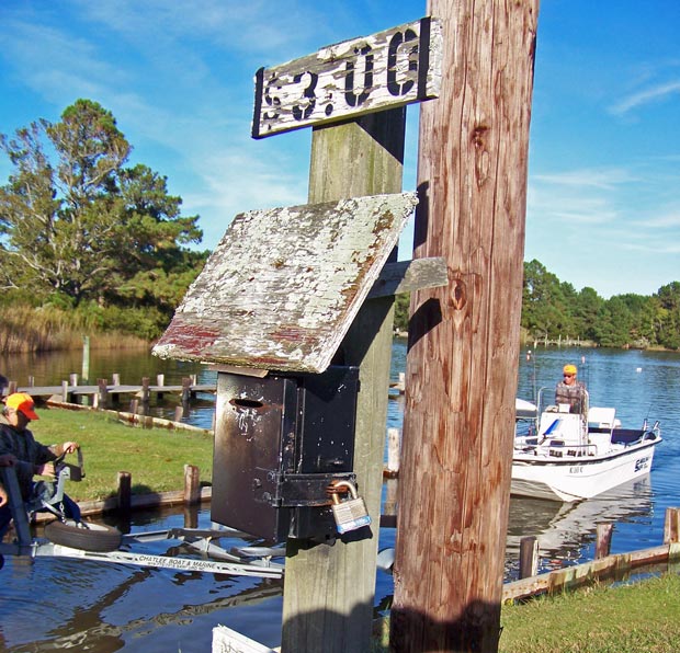
Fishing in the ICW at the Hobucken Bridge
(click image to enlarge)

This couple was fishing from a dock at the R.E. Mayo & Co. fish-house, just across the Atlantic Intracoastal Waterway from the community of Hobucken (see map below)

The bridge on the left side of the photo crosses the ICW from the Pamlico County "mainland" to Goose Creek Island (also in Pamlico County)

This modern bridge was completed about eleven years ago, replacing an old 1920's vintage steel truss swing-span bridge... you can see the old swing-bridge abutment on the other side of the ICW, also with a couple of fishers on it.

The new Hobucken fixed-span bridge was constructed by the U.S. Army Corps of Engineers, and was completed under-budget and ahead of schedule.

In order to avoid interfering with the heavy traffic on the ICW (or having the traffic interfere with it), the bridge was designed to span the ICW with no piers in the water, resulting in the longest bridge span in North Carolina.

Here is a USACE photo of the bridge nearing completion (you can see the Mayo docks, lower right of the bridge, and the U.S. Coast Guard Hobucken Station in the clearing to the left of the bridge... click image to enlarge), followed by a map of the location:

(Click image to enlarge)

Hobucken bridge over ICW, and R.E. Mayo & Co. fish-house locations:

View R.E. Mayo & Co. fish house, Hobucken NC in a larger map

-30-

Tuesday, September 29, 2009

9.29- Smith's Friendly Mini Mart

The old Smith's store in Mesic, NC

Mesic is an incorporated town in Pamlico County, NC with a population of fewer than 250 folks. It is just across Vandemere Creek from the town of Vandemere (see prior two posts) on the Bay River (see map, bottom of post)...

The information below is a summary of info I learned about Mesic and its families from the research and writings of Bill Smith (a.k.a. "Poppa Bear") of Mesic - my source is a very intriguing (if somewhat enigmatic) genealogical/history web site put together by Bill Smith bout his 11 year quest "In Search of Rodger - 1710-2009."

The above store (no longer in operation) is owned by the Smith family, descendants of "Maricay," b. 1710, a mestizo slave from Maracay, Venezuala who ended up as a slave of the Midyette family in Hyde County. (No doubt part of the same Midyette family which subsequently produced Oriental's founder Ropert P. Midyette, who in 1873 migrated from Dare County to purchase the land that eventually became the town of Oriental.)**

Maricay's son, Charles, married Elizabeth Jennett, who "was said to have been on the English slave ship Good Intent and ended up in Hyde County after the ship was wrecked near Cape Hatteras in 1767."

Charles and Elizabeth gave birth to their son "America" on July 4, 1776.

America, who was legally granted freedom by the Midyette family in 1808, was Poppa Bear's great-great-great-grandfather... America had 10 children, four of whom had been born before or during 1808... I have not yet found any mention about whether America's wife or children were also given their freedom in 1808.

It seems that many of Mesic's current residents, about 70% of whom are African-American, are descendants of slaves held by some of eastern NC's earliest European settlers (at least the ones that didn't mysteriously disappear) - including McCotter, Credle, Midyett, Green, Blunt, and O'Neal - whose surnames were adopted by their former slaves upon gaining their freedom, before and after the Civil War.

According to Poppa Bear;
"After the Civil War was over, some time in the late 1860's. Old man
Jacob McCotter needed farm hands to work his farms, so he hired a
large boat to bring some of our ancestors from Hyde Co. this boat
landed in Lowland. [Another ancestor,] Rodger [Smith] and his family
migrated to Pamlico Co. in the early 1880's. They also came by boat
and landed in Lowland...

"They worked on the area farms, clearing farm land digging drainage
canals and in the lumber camps. They worked hard from sun up to
sunset and saved what they could so that they could buy land and build
their homes..."
Mr. "Poppa-Bear" Smith's web site is chock full of fascinating documents (including copies of wills conveying his ancestors), historic photographs, oral histories and anecdotes related to his 11-year effort to to trace his family's ancestry to its African roots... As Mr. Smith quotes his Aunt Louisa (b. 1896.), "We've come a long way, children."

See Mr. "Poppa-Bear" Smith's family history web site at http://poppabear.org/

The official Town of Mesic website is at http://www.mesictownof.com/
Smith's Friendly Mini Mart location in Mesic, NC:


View Smith's Mini Mart, Mesic, NC in a larger map


** Yes, I know the "official" Oriental history published by the Oriental Tourism Board credits Louis B. Midyette with founding the town, but my research strongly suggests otherwise.


-30-

Monday, September 28, 2009

9,28- Summons to Ophelia?

"Exit" sign leading to a boat ramp in Vandmere

This sign made me think of Shakespeare's "Ophelia," Hamlet's love interest who escaped her hopelessness and Hamlet's increasing madness by descending into the waters of a stream, singing a last song as the weight of her clothing pulled her under.

Luckily, this boat ramp is used for much more cheerful purposes, like going fishing!

It is located at the end of First St. in Vandemere, between two fish-houses, the Pamlico Packing Co. (see yesterday's posting) and McCotter's Seafood Co.

I have read in various places that, at least in NC, where a public street ends at water it is normally presumed to be usable for public (i.e. free) access to the water.

It certainly appears that this ramp is at the terminus of First St. on the water (see photo, left)...

And the Pamlico County Tax office map shows First St. extending to the waterline (see below, click to enlarge, red parts added by me).


The Pamlico County tax map has, however, been known in the past to offer misleading depictions of taxable properties and street-ends) The map shows the property to the east of the ramp belonging to Pamlico Packing, and that west of the ramp to the heirs of H. Carawan, and the public right-of-way is shown going all the way to the water where the ramp is located.

But this ramp has an "honor-box" next to it (see below,) a sure sign that someone considers it to be a private ramp... no indication on the box as to who that might be - just a faint etching of "$5.00 RAMP FEE" (hard to see - click on image to enlarge)


Another Pamlico County street-end mystery... well, the deed searching on this one belongs to someone else.

Here is the spot on Google Maps:

-30-

Sunday, September 27, 2009

9.27- Vandemere fish-house

Ice-house at the Pamlico Packing Co. complex on First Street in Vandemere
(click on image to enlarge)
Today I took an afternoon drive to some parts of Pamlico County I have not previously visited by land.

This is one of the buildings at the "Pamlico Packing Co." fish-house complex on First Street in the town of Vandemere (population 289)(Vandemere town web site here), at the confluence of Vandemere Creek into Bay River (see map below). A "fish-house" is a place where commercial fishing vessels can dock and unload their catch for processing, packing and loading onto trucks for trans-shipment.

This building was (is?) apparently the ice-house on the complex... Commercial fishing vessels need vast quantities of ice in their holds to keep their catches fresh until they get back to the fish-house, so ice production is a standard function at fish-houses.

According to this New Bern Sun Journal article about Vandemere, the "Pamlico Packing Co." was formerly the "I.J. Packing Co." until purchased and renamed in 1941 by Earl Holton and his brother-in-law Robert Whorton (who also once owned a packing and canning company here in Oriental.)

I can find nothing about "Homer Wall," whom the sign on this building identifies as the owner of "Wall's." According to Pamlico County tax records, the part of the complex on which this building stands is owned by Pamlico Packing and "Vandemere Ice Co.," which NC Sec'y of State in turn indicates is still owned by the son-in-law of Earl Holton...

A local informed me the fish-house is still operational, though it looks to me like some of the buildings are not used very much, if at all.

The ice-house building is marked on the map below:

View Vandemere fish house in a larger map

-30-

Tuesday, April 14, 2009

4.14- Foul-Weather Gear

Commercial fishing crew working the River Neuse

Local commercial fisherman, Capt. Keith Bruno, sets gill-nets along the banks of the River Neuse between Windmill Point and Wiggins Point. (See map below)

Helping the Capt. are his two sons, Zack and Ben. Ben is on the bow tossing over the gill-net as Capt. Bruno backs away from the anchor buoy at the end of the net (yellow object in water, left side of photo.)

It was a rainy day in the area... I was lucky to see the Bruno crew cruising the river during a lull in the rainfall. Of course I got to get back in the car when the rain started pouring, while the Brunos motored off into the rain to set five more nets before the day was done.

Make sure to drop by Capt. Bruno's "Endurance Seafood" fish-house (and chicken-house, peacock-house, duck-house, dog-house and people-house) next to Pecan Grove Marina during the Oriental Boat Show this weekend (see boat show web site here)...

You will be able to tour Bruno's other commercial fishing vessels (they are quite a bit bigger than the above Carolina Skiff), and it's a

great place to get some local "Fish so fresh it bites!"

...as the motto on the Endurance Seafood sign along Hwy 55 (just over the bridge from Oriental, see red marker on map below) proclaims.

You can read more about Capt. Bruno at my Oct. 14, 2008 posting, "Endurance - Part One." (Part two is still in pre-production)

View Windmill and Wiggins points in a larger map

-30-

Thursday, March 19, 2009

3.19- "Thirsty Thursday" at The Silos

The Silos Restaurant & Saloon at twilight


The Silos is located on NC Hwy. 55 just a couple hundred yards outside the Oriental town limits.

It always draws a large crowd on Thursdays for $1.00 pint draft beer specials... including Yeungling, my preference.

Complementary peanuts are a signature of the place, though the new owners/management (who came in last year) introduced the revolutionary concept of sweeping up the peanut shells off the floor every few days or so... prior owners did not, and peanut shells formed dunes and drifts wherever people did not walk... Some customers, including myself, favor the old leave-em-on-the-floor approach.

From what I understand, these were actual silos on the property, converted into a bar/restaurant by the previous owners... Currently, only the left-hand silo is open for business.


-30-

Sunday, February 1, 2009

2.01- Superbowl oysters


Superbowl Sunday... I was invited to a pre-game oyster-bake out near Dawson's Creek today. The event featured two giant burlap sacks full of fresh live oysters, which were eaten after steaming.

Friends, family, relatives, and regular readers will know that I am not a huge seafood fan, to say the least, and oysters are near the bottom of my "edibles" list...

Nonetheless, I did eat a few, and they pretty much tasted like the garlic-butter-worsteshire sauce or horseradish-ketchup-tobasco sauce I dipped them in. I did eat one without sauce, but quickly washed it down with plenty of Pepsi-cola while repeating to myself "I did not just eat a slimy mucous from a shell" over and over again.

The other folks at the pre-game party thoroughly enjoyed the oysters... the host's father told me he had eaten somewhere between 30 and 40 of the bivalve mollusks, the very thought of which made me feel a little green.

As one of my favorite authors, Jonathan Swift, once said "He was a bold man that first ate an oyster."

I struggled with the oysters, but enjoyed the company, the other available edibles and drinkables, and the accompanying pool tournament in the back shed before heading back to Oriental and the local pub for the Superbowl. My favorite part was the guy hitting the Koala.

-30-

Friday, January 16, 2009

1.16- Frozen Collard Greens


Collards for sale - $ 0.75 per lb.
Fresh collards for sale on the roadside in Grantsboro, Pamlico Co.

The collards risk becoming frozen, however, as temperatures did not rise above freezing today... A traditional Southern staple for sale in decidedly un-Southern weather!

One often sees collards for sale along Pamlico Co. roadways (and, I suppose, across the North Carolina and the South in general) , particularly in the fall and winter.

Collard greens are typically boiled with some part of a pig (hog-jaw, ham-hock, fat-back etc.) and seasoned with a little vinegar, salt and "secret" ingredients according to the cook.

Personally, I have a hard time eating the durn things... But since they are a staple offering to guests at pot-lucks and dinner parties, I regularly have to gulp down at least a token amount in respect to my hosts.

Collard greens are also required eating on New Years day. I grew up eating black-eyed peas on New Years because they bring good luck for the new year, but at least around here one must also eat collards, which bring good fortune (in the monetary sense) in the new year.

Brrrrrr, it's COLD today!
-30-

Saturday, December 27, 2008

12.27- Paradise Cove Boat Ramp

Catfish "honor box" (under surveillance) at Paradise Cove Marina's boat ramp
(Click on image or here for full size)


Today I drove my visiting brother Fred around for a tour of Pamlico County.

Found this catfish drop-box for ramp fees at the Paradise Cove Marina boat ramp. I was surprised to see that the catfish itself is approved for use as a U.S. Postal Service delivery box (before it was modified, at least.)

Paradise Cove Marina expanded it's marina this year... The marina also boasts a fine bar / deck, open weekends during the season, and available for private parties.

Great place for a sunset and refreshments during the season... but remember to bring some DEET!

Small boat ramp, fee is $5.00.

Where is Paradise Cove Marina, NC?

View Larger Map

-30-

Monday, December 8, 2008

12.08- Lee's Landing


A fisherman prepares to pull his boat onto its trailer at the Lee's Landing Wildlife Ramp
Lee's Landing is yet another place you can put your boat in the water in Pamlico County.

This landing is a North Carolina Wildlife Resources Commission Public Boat Ramp (aka "Wildlife Ramp") location, so there is no fee to use the boat ramp here.

Lee's Landing is on upper Broad Creek, which runs into the Neuse River, and is not far from the "big city" of New Bern, NC:


-30-

Sunday, December 7, 2008

12.07- Thirty Seven Cents per Gallon


Gas pumps in front of moribund Texaco station on Florence Road


Way out in Pamlico County, on Florence Road, stands this old Texaco gas station.

The pumps indicate 37 cents per gallon... they must have last been set in 1971 or 72.

While the station and store are no longer open for business, the pumps, lube containers and other artifacts have been kept in good shape and are on display out front, while a collection of old soda bottles decorate the front window sills: See more photos of this Texaco on my other blog, The Dinghy Dock.

This property is owned by a member of the Day family, which family also owns the nearby "Day's Landing," featured in my prior post of October 20.


-30-

Friday, December 5, 2008

12.05- Celestial alignment - Skywatch Friday


The Moon, Venus and Jupiter in alignment

My "Skywatch Friday" photo this week comes from the night of December 1, 2008.

The waxing crescent Moon flew past Venus and Jupiter tonight (in the picture, Venus and Jupiter are seen through the tree... Venus is the second brightest object in the sky, with Jupiter the third)

This is apparently an astronomical rarity.

The steeple in the foreground belongs to the new Bethany Christian Church in the nearby burg of Arapahoe, NC.

The new church replaces one that burned down on June 25 of 2007.

You can see the story of Bethany Church's corporeal destruction and inspiring rebirth at their blog site.

I had a hard time balancing between the very bright moon and the relatively dimmer (but still bright to the naked eye) Venus and Jupiter... Some pictures showed the moon better, more like the crisp crescent it was, but Venus and Jupiter were just too dim in those shots. I picked this picture because the planets show up well, even though the moon as a consequence is overexposed.

It was an awesome sight, particularly out in the country away from the few towns around here.
HAPPY SWF EVERYONE!
I look forward to seeing the other Skywatch pictures from around the world on the other SWF sites listed at:


-30-

Thursday, December 4, 2008

12.04- "Whoa!"


A horse obeys the sign hanging on her barn

I found this scene on "Teach's Cove Road," which runs the spit of land between Smith's Creek and Green's Creek to Dewey Point, right across the creek from Oriental.

The road is named for Captain Edward Teach, AKA "Blackbeard" the pirate.


Notorious buccaneer and frequent North Carolina resident Blackbeard,
pictured with his trademark lighted fuses protruding from beneath his hat


Legend has it that Blackbeard would occasionally camp out the peninsula "for relaxation," and that he buried some treasure below a now-vanished tree on the point:
"Teach's Oak is located almost at the water's edge on a peninsula farm lying between the Neuse River and two creeks, Smith and Green. Large and ancient, and now gnarled and bent, the old tree was many years ago named after the infamous freebooter. Local tradition avers that Blackbeard posted a sentinel in its branches. There is evidence that the area has been dug up in the search for buried treasure, but none has been found."

- Blackbeard the Pirate - A Reappraisal of His Life and Times, Robert E. Lee (Blair, 1974), p. 172

The location of "Teach's Oak" and Oriental are shown on the map below:


View Larger Map

-30-

Wednesday, December 3, 2008

12.03- Otter vs. Boxer


A dog faces off with a North American River Otter in a drainage ditch along Kershaw Road

As I was driving along Kershaw Road between Arapahoe and Oriental, I saw two dogs running into the middle of the road ahead... as I slowed down and got closer, I saw a North American River Otter leaping around in the road between the dogs.

The otter ran off the road into the drainage ditch, with the two dogs on its' tail.

As I pulled over, a man came walking across the road from his home (obviously where the dogs and otter had come from) carrying a seven-foot long metal pole.

I got out of the car with my camera and started shooting... by this time the otter was in its' element, while the boxer and another dog were hesitant to step in the water, not knowing where the submerged otter was exactly.

The dogs would run back and forth along the water until the submerged otter lunged up from a hiding place under the water, snapping at the dogs faces... The dogs would jump back, the otter re-submerge, and the whole thing repeated. It kinda reminded me of the Trash Monster in Star Wars. (See posting on my other blog, "The Dinghy Dock" for additional photographs)

At one point, the boxer was scanning the water for the otter, with its front paw in the water... The dog gave a sudden yelp and leaped back, obviously having been bitten on the paw.
The man with the pole came up, and I thought he might use the pole to nudge his dogs away so the otter could escape... It would certainly have been foolish to try to get in between the animals.

Instead of using the pole to break up the dogs, however, the man raised it above his head and brought the pole down full force towards the otter's head! He missed, but I was flabbergasted, and a little fearful for myself and the nearby parked car.

The man tried a second time to hit the otter with the pole, but he slipped and landed rump-first in the mud next to the water... A little divine justice?

At that point the man's wife came walking across the road with a shotgun, saying "what do you want me to do with this? I don't know how to use this, you better come get it."

OK, I thought, time to move the car and get a little removed from the shotgun.

I jumped in the car, drove about 50 feet along the shoulder, then looked back to see the man shooting into the woods. His wife handed him a second shell, he loaded and fired again towards the woods, this time farther away...

(See posting on my other blog, "The Dinghy Dock" for additional photographs)


His wife handed the man a third shell, but he did not shoot again...

The dogs meanwhile were running around the ditch and edge of the woods looking for the otter, apparently with no luck. Hopefully the otter escaped unharmed.

I'm not sure why the man wanted to kill that otter... He had a shotgun and a tracheotomy, though, so I decided against trying to ask him anything about it.

Otters do not seem to be known as farm pests, though they will eat small birds (including, I suppose, small chickens) and their cousins the weasels are widely regarded as farm pests.

Could be he wanted the otter pelt, which might explain why he tried braining the creature before shooting at it.

Maybe it was just afternoon entertainment.

Anyway, I was glad to see that the otter at least made it off into the woods.


-30-

Thursday, October 30, 2008

10.30- Bayboro Airport


A lone small airplane sheltered in the hanger of the Bayboro Airport


While I was in the Pamlico County seat of Bayboro today, I decided to cruise by the "Bayboro Airport" I had noticed on my road map.

The airport consists of an empty stretch of grass amongst farmland, a single airplane hanger, a windsock, a dilapidated shed, and several apparently-abandoned-vehicles:


Behind the hanger rests this moribund hobbyist's hanger for the "Down'n the County Radio Control Flyers:"


Call early to reserve your flight!


-30-

Monday, October 20, 2008

10.20- "Day's Landing"


"Honor box" at the Days Landing boat ramp on Ball Creek.
Today I went out exploring the nearby Whortonsville and Florence areas of Pamlico County, looking for creek entrances for some possible kayaking.

I found these three camouflaged anglers taking their Carolina Skiff out at "Day's Landing" on Ball Creek, which runs into the Bay River near Florence.

Don't ask me why the anglers were all wearing camo... I cannot imagine that it fools any fish, and none of these guys had guns, so they weren't hunting... and anyway they have made no attempt to disguise their Carolina Skiff.


I will chalk it up to a general outdoorsman lifestyle, which I admittedly know little about except for an occasional trip to Bass Pro stores, where camo certainly appears in abundance.

This seems a good place to put in a kayak for a paddle around Ball Creek, Bonner Bay, Spring Creek and Long Creek.

... And from the looks of the sign, Day's Landing has not raised their ramp fee in some time!

Explore Ball Creek ("Day's Landing" is at the map marker), Bay River, Bonner Bay etc. on Google Maps:

View Larger Map

-30-

Monday, August 18, 2008

8.17- Smoke 'em if ya got 'em


Tobacco plants in a field near Arapaho, NC (a couple miles from Oriental).

-30-