A photo a day from Oriental, NC, the surrounding Pamlico County area, and nearby rivers, creeks, bays and other waterways of coastal North Carolina.


Oriental Daily Photo is a member of the City Daily Photo blog network.
See daily photos of other towns and cities around the world at:
CDPB Logo

Showing posts with label U.S.M.C. Cherry Point. Show all posts

Monday, January 26, 2009

1.26- Seals in Raccoon Creek

An 11 meter Naval Special Warfare Rigid Inflatable Boat cruises up Raccoon Creek
(Click on image or here for full size)

I usually see these 11m NSW-RIBs way out in the Neuse River cruising at 45 knots between the Cherry Point Marine Station and the Piney Island / BT-11 target range...(see related prior postings re: NSW-RIBs and the BT-11 target range)

I was watching this one headed back up-river towards Cherry Point when it surprisingly turned into the Oriental Harbor channel.

So I grabbed a camera and headed down to the Oriental Yacht Club in time to find the boat slowly cruising up and down Raccoon Creek...

One guy on board was pointing out various things around the harbor and creek-sides... I wonder if it was some sort of tactical orientation or a simple sightseeing side-trip after a day of storming Piney Island?

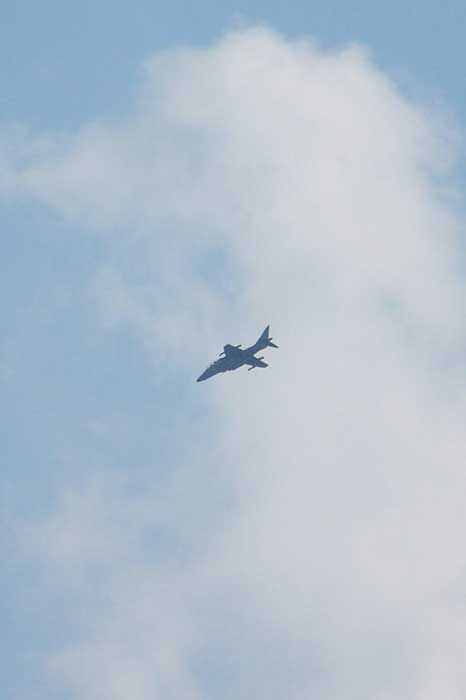
I have noticed a lot of U.S. Marine air traffic over the river the past couple of days, including Harriers, CH-35E Sea Stallion helicopters (see related prior posting re:CH-35E), CH-46 Sea Knight helicopters, and MV-22B Osprey VTOL/STOLs.

I'm guessing these guys are U.S. Navy SEALS, as the NSW-RIB's primary mission is SEAL insertion and extraction, and I have not found any reference to the U.S. Marine Corps using them.
-30-

Saturday, December 20, 2008

12.20- "Sugar's" - (Skywatch Friday is prior post, below)


"Sugar's"

Today I went to Havelock to run some errands, and snapped this from the car.

This is, one must suppose, a bar.

I'm always curious about bars with no windows (adds some suspense for first-time patrons opening the door)... but I have yet to visit this one, so I can't tell you much.

"Sugar's" is located across the road from the U.S. Marine Corps Air Station at Cherry Point, which helps explain the bulldog with a helmet. Military bases always have windowless bars across the street in my experience.

From Oriental it is a twelve mile drive and a ferry ride away. I have previously featured the Cherry Point - Minnesott Beach ferry in my post of 11.17.08.

-30-

Monday, November 17, 2008

11.17- Minnesott Beach Ferry


Minnesott Beach-Cherry Point ferry

This is the ferry that crosses the Neuse River between Minnesott Beach and Cherry Point. Minnessot Beach is 12 miles from Oriental, and is the nearest place you can cross the river without your own boat, particularly if you are driving a car or truck.

The ferry is seen here from the Minnesott Beach side, framed between pilings at the ferry port on this side of the river.

The ferry leaves from each side of the river every 30 minutes or hour (depending on time of day) and the ride takes about 15 to 20 minutes. The ride is free.

The ferry doesn't run in high winds, storms, or heavy fog...

If the ferry isn't running because of any of the above, you have to decide whether it is best to wait out the weather, or drive all the way up the river to New Bern, cross the river bridge, then drive down the other side of the river ... it takes about an hour or so of driving.

-30-

Thursday, November 6, 2008

11.06- "Sea Stallion" - USMC CH-35E


A USMC CH-35E "Sea Stallion" helicopter flies over the Neuse River on its way from Cherry Point Marine Corps station to the BT-11 target zone on Piney Island at the mouth of the Neuse River

These are new birds in the neighborhood skies... Heavy Marine Helicopter Squadron 366 recently moved to the U.S. Marine Corps station at Cherry Ridge, about 12 miles up the Neuse River from Oriental.

HMH-366 aircrews flies CH-53E Super Stallions, the Marines' "heavy haulers." The unit has been relocated to Cherry Point from reserve unit locations around the country.

According to the Federation of American Scientists, the CH-35E :

"...is designed for the transportation of equipment, supplies and personnel during the assault phase of an amphibious operation and subsequent operations ashore.

"Capable of both internal and external transport of supplies, the CH-53E is shipboard compatible and capable of operation in adverse weather conditions both day and night.

"... The twin-engine helicopter is capable of lifting 7 tons (6.35 metric tons)

"... The helicopter will carry 37 passengers in its normal configuration and 55 passengers with centerline seats installed."
-30-

Tuesday, July 29, 2008

7.28- Marines Attacking Piney Island, NC


Marine Corps aircraft frequently fly over and around Oriental... they fly out of Cherry Point Marine Corps Air Station near Havelock, NC, about ten miles Southwest of Oriental, and "attack" a multitude of targets in the "BT-11" multi-purpose target complex (read more about BT-11 here) on and around Piney Island, just off the Neuse River about ten miles East of Oriental.

One can often see attack helicopters, AV-8B Harriers ("Jump Jets") and V-22 Osprey flying around. I have seen helicopters hovering over the target and actually firing live ammo at it (I'll try for a photo next time I see it), but the planes only use simulated/electronic targeting or dummy ammo for their runs.

I think today's picture is of a Harrier, but then again it might have been an F-16. If you can tell, please drop me an "Ahoy" below.

In the Google Map below the red line runs between Cherry Pt. and the target area... If you click on "Satellite" and use the map controls to zoom into the Eastern (right hand) end of the red line, you can see a scuttled yard freighter class ship they use as a target... pan around Piney Island and you can see a bunch of the targets listed in the link to BT-11 info above:


-30-