A photo a day from Oriental, NC, the surrounding Pamlico County area, and nearby rivers, creeks, bays and other waterways of coastal North Carolina.


Oriental Daily Photo is a member of the City Daily Photo blog network.
See daily photos of other towns and cities around the world at:
CDPB Logo

Showing posts with label Green's Creek. Show all posts

Friday, May 1, 2009

5.01- Windex installation

Captain Robbie descending after installing a Windex on top of the mast
(Click on image to enlarge)

Sailing season preparations continue... Today Capt. Robbie installed a Windex on his Catalina 25, "Coriolanus."

For my non-sailing readers, the Windex is the weather-vane looking contraption on top of the mast... I lets you know the direction of the wind (the apparent wind, anyway) and the two little tabs on either side of the arrow thingy let you know where the "no-sail zone" is at any given moment... See, you can't sail a sailboat directly towards where the wind is coming from, and can only sail so-many-degrees (varies by boat and other conditions) "close to the wind"... If you sail too directly into the wind, the sails will not be able to create the high/low pressure differential that is the basis of sail power... and you then find yourself within...the "No-Sail Zone"

If the "Coriolanus" were sailing and the Windex was as appears in the picture, she would be sailing on a "starboard tack, close reach," meaning sailing nearly as much towards the wind as she can, and with the wind coming over the right-hand side of the boat (as you face forward on the boat).

Capt. Robbie ascended the mast in a bosun's chair, drilled holes, mounted the hardware, and eventually was lowered down.

I dropped by to lend my assistance... luckily for Capt. Robbie there were four of us down on the boat and the pier, splicing main-braces in the beating sun, and giving Capt. Robbie as much helpful advice on how to install the thing as he could possibly wish for (and maybe even a little extra on top of that.)


-30-

Thursday, April 30, 2009

4.30- SkyWatch Friday - Sunset over Green's Creek

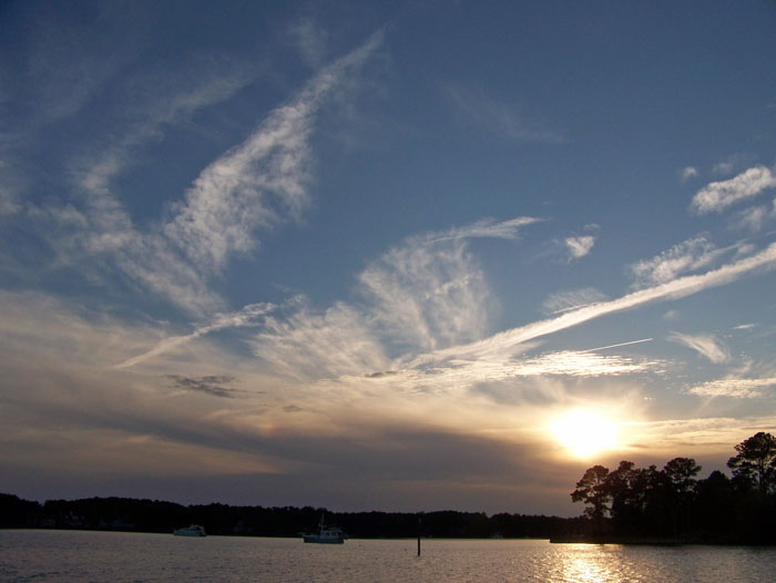
Sunset over Green's Creek and Kershaw Creek

My SkyWatch Friday pic today comes from last night's sunset.

The view is from the NC Hwy 55 bridge over Smith's Creek, looking up into Green's Creek (marked with channel markers, then bears off to the left at the top of the pic) and Kershaw Creek (branching off to the right, just under where the sun would be if you could see it.)
HAPPY SWF EVERYONE!

I look forward to seeing the other Skywatch pictures from around the world on the other SWF sites listed at:

-30-

Saturday, October 18, 2008

10.18- Green's Creek Challenge


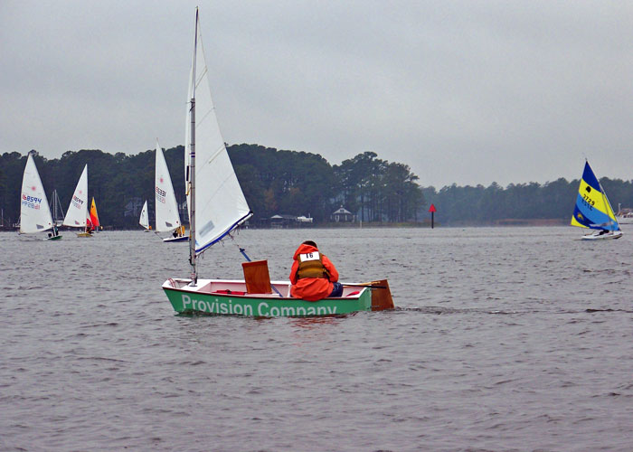
An Optimist dinghy heads down-wind towards the finish line in today's Green's Creek Challenge race, while Laser and Sunfish boats round Dewey point towards the Smith's Creek race marker.

A cool rainy day for today's Green's Creek Challenge, an annual sailboat race for boats under 20 feet sponsored by the Oriental Dinghy Club.

The race route began in Oriental Harbor, passed under the bridge, up Green's Creek, back down to Dewey Point, up Smith's Creek and back to the start.

The ODC had not posted results as of this writing.

I have posted additional pictures from the race on today's entry on The Dinghy Dock...

-30-

Thursday, October 9, 2008

10.9- Skywatch Friday - Mixed sky

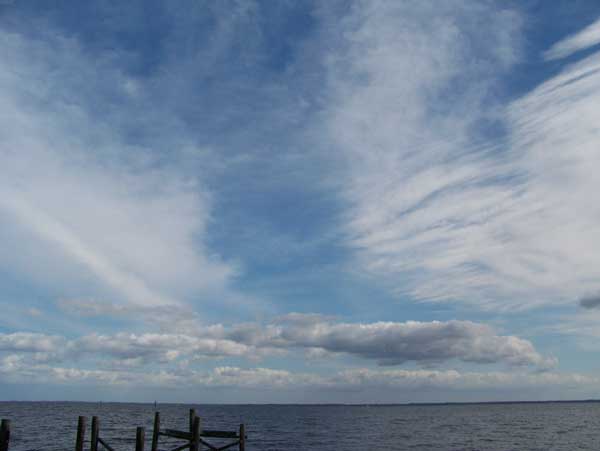
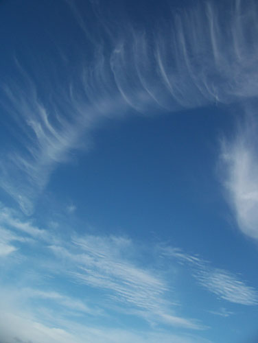
A mix of clouds fills the western sky over Green Creek
(Click on picture or here for full size)

Inspired by Dewdrop's recent Cloud Lessons on the Skywatch Friday site, I have been trying to learn my clouds, and taking a lot of pictures of clouds so I can study and compare them with pictures and descriptions in weather books and on-line.

As Dewdrop rightly pointed out, a sailor should know clouds, so I am slowly working through "Weather for the Mariner," by William J. Kotsch, Rear Admiral USN (Ret.), and refering to a couple of other weather-for-sailors books I have access to... unfortunately, they are all a bit dated, featuring black & white photos and lots of information on a (I assume) now moribund network of "telefacsimile"-transmitted isobar maps that seems to have been on the cutting edge of weather info sometime in the ancient past.

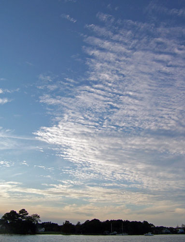
Today's main picture features a mixed sky, which I think includes cirrostratus, cirrus, altocumulus and/or cirrocululus (I can't quite tell the difference between those two), a tad of fractostratus, and some condensation trails.


I think... The hardest part for me right now is determining the altitude of the clouds I see, both in absolute terms and in relation to other clouds. I am hoping it is just a matter of looking at the skies a bit more (SWF has prompted me to do that) and to patiently do my homework on clouds and weather systems (as noted earlier, Dewdrop has inspired me to do that.)


I am still using the books to decode todays pictures, (taken yesterday), and am watching the shifting fronts and pressure systems on NOAA and WeatherUnderground to get a sense of why the sky filled with so many different types of clouds yesterday after several days of pure blue sky.


I would love to hear comments from the SWF community about the types of clouds in today's pictures.

Here are a few more cloud pictures, also taken yesterday:

#2) More mixed clouds, this time facing East over the Neuse River:


#3) Altocumulus or Cirrocumulus ??? (facing just north of west):


#4) Straight above... condensation trail becoming cirrus ???


I look forward to seeing the other Skywatch pictures from around the world on the other SWF sites listed at:

-30-

Thursday, September 4, 2008

9.03- Sailing with the Dolphins

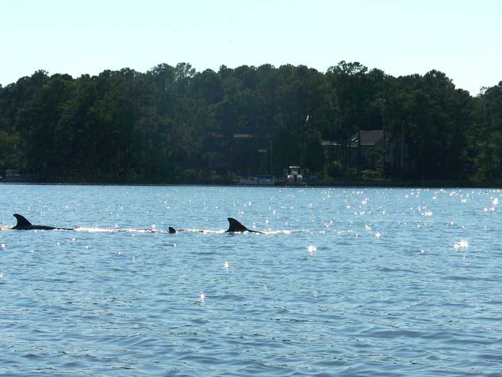
Dolphins (probably bottlenose) surface while hunting in Camp Creek.

While out sailing in the Bauer dinghy, I found these guys swimming in circles around the mouth of Green's Creek, where it merges with Smith Creek before flowing out into the Neuse River. I am guessing they were hunting... the creeks are full of shrimp and minnows of all sorts.

The dolphins were swimming in a wide circle around the entire mouth of Green's Creek, and I had little luck keeping up with them in some fickle and weak winds. I also had little luck with the camera, as it is a tad difficult to get decent shots while trying to hold the tiller and the mainsheet at the same time.

After doing my best with the camera for a while I set it aside and relaxed into the boat, sailing around and listening for the dolphins blowing as they surfaced...

"poof... poof... poof" would alert me to their surfacing, and I could turn my head in time to see them arching back down into the waters, and others coming to the surface behind them... just like in this short video I was also able to capture:

-30-