A photo a day from Oriental, NC, the surrounding Pamlico County area, and nearby rivers, creeks, bays and other waterways of coastal North Carolina.


Oriental Daily Photo is a member of the City Daily Photo blog network.
See daily photos of other towns and cities around the world at:
CDPB Logo

Showing posts with label aircraft. Show all posts

Thursday, March 12, 2009

3.12- Skywatch Friday - Sunrise over Chadwick Point


The sun rising over Chadwick Point (home of Point Pride Seafood)

Today's picture is from a boating trip earlier this week... a neighbor and I joined mutual neighbor Capt. Miller on his May Craft 1900 for a trip across the River Neuse, into Turnagain Bay, and through the "Indian Ditch" connecting Turnagain with Long Bay. (see prior post, below)

We left from the Wildlife Ramp on Smiths Creek and were crossing the mouth of Smiths Creek / Oriental Harbor just as the sun peeked over the point. An itinerant catamaran was at anchor in the harbor.

The rising sun illuminated the web of contrails left in the dry atmosphere by the many high-altitude commercial airplanes moving up and down the East Coast flight corridors.

HAPPY SWF EVERYONE!

I look forward to seeing the other Skywatch pictures from around the world on the other SWF sites listed at:

-30-

Thursday, November 6, 2008

11.06- "Sea Stallion" - USMC CH-35E


A USMC CH-35E "Sea Stallion" helicopter flies over the Neuse River on its way from Cherry Point Marine Corps station to the BT-11 target zone on Piney Island at the mouth of the Neuse River

These are new birds in the neighborhood skies... Heavy Marine Helicopter Squadron 366 recently moved to the U.S. Marine Corps station at Cherry Ridge, about 12 miles up the Neuse River from Oriental.

HMH-366 aircrews flies CH-53E Super Stallions, the Marines' "heavy haulers." The unit has been relocated to Cherry Point from reserve unit locations around the country.

According to the Federation of American Scientists, the CH-35E :

"...is designed for the transportation of equipment, supplies and personnel during the assault phase of an amphibious operation and subsequent operations ashore.

"Capable of both internal and external transport of supplies, the CH-53E is shipboard compatible and capable of operation in adverse weather conditions both day and night.

"... The twin-engine helicopter is capable of lifting 7 tons (6.35 metric tons)

"... The helicopter will carry 37 passengers in its normal configuration and 55 passengers with centerline seats installed."
-30-

Thursday, October 30, 2008

10.30- Bayboro Airport


A lone small airplane sheltered in the hanger of the Bayboro Airport


While I was in the Pamlico County seat of Bayboro today, I decided to cruise by the "Bayboro Airport" I had noticed on my road map.

The airport consists of an empty stretch of grass amongst farmland, a single airplane hanger, a windsock, a dilapidated shed, and several apparently-abandoned-vehicles:


Behind the hanger rests this moribund hobbyist's hanger for the "Down'n the County Radio Control Flyers:"


Call early to reserve your flight!


-30-

Tuesday, July 29, 2008

7.28- Marines Attacking Piney Island, NC


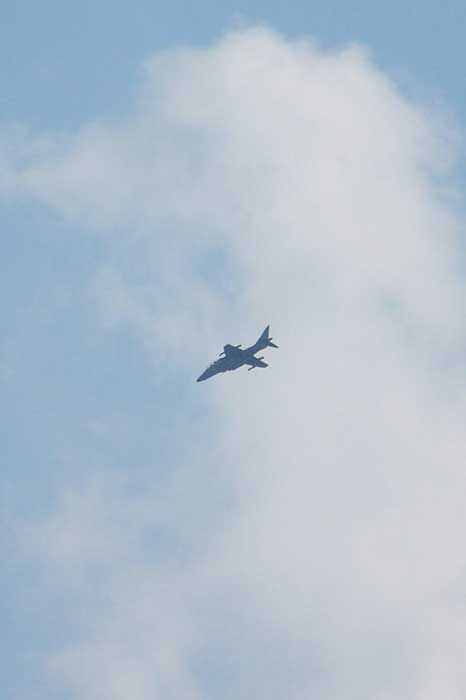
Marine Corps aircraft frequently fly over and around Oriental... they fly out of Cherry Point Marine Corps Air Station near Havelock, NC, about ten miles Southwest of Oriental, and "attack" a multitude of targets in the "BT-11" multi-purpose target complex (read more about BT-11 here) on and around Piney Island, just off the Neuse River about ten miles East of Oriental.

One can often see attack helicopters, AV-8B Harriers ("Jump Jets") and V-22 Osprey flying around. I have seen helicopters hovering over the target and actually firing live ammo at it (I'll try for a photo next time I see it), but the planes only use simulated/electronic targeting or dummy ammo for their runs.

I think today's picture is of a Harrier, but then again it might have been an F-16. If you can tell, please drop me an "Ahoy" below.

In the Google Map below the red line runs between Cherry Pt. and the target area... If you click on "Satellite" and use the map controls to zoom into the Eastern (right hand) end of the red line, you can see a scuttled yard freighter class ship they use as a target... pan around Piney Island and you can see a bunch of the targets listed in the link to BT-11 info above:


-30-