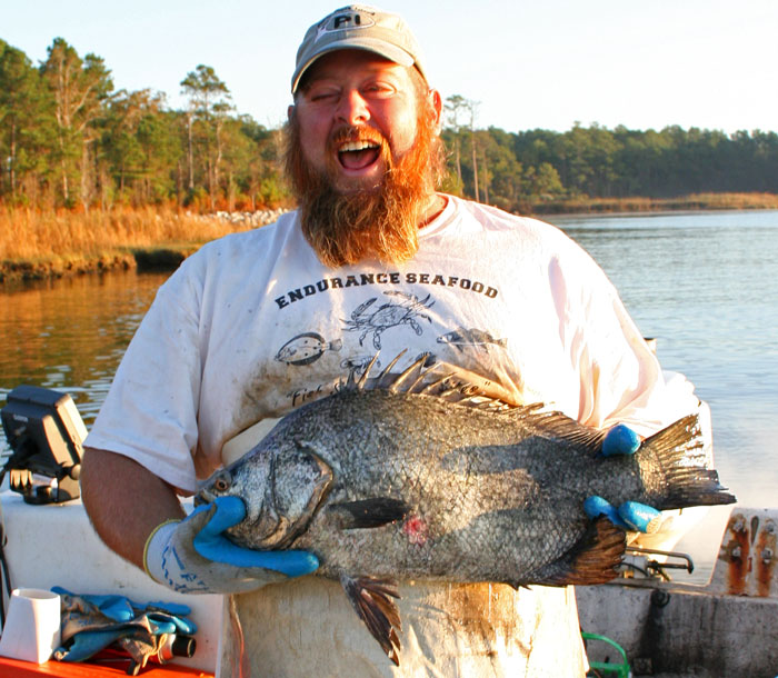
 Captain Keith Bruno is pleased with this Atlantic Tripletail (Lobotes surinamensis) he pulled from one of his gill-nets along the Neuse River near Pierce Creek
Bruno, a commercial fisherman, does his own catching and his own retail selling of many fruits of the local waters... But after removing the rare Tripletail catch from his net, he proclaimed "you can't buy this one from me!"
Today and tomorrow, I will be bending the "City Daily Photo" rules to introduce you to Captain Bruno.
I hope you enjoy meeting him as I did...
Today I had the pleasure of accompanying
Endurance Seafood owner Capt. Keith Bruno as he pulled his gill-nets set the previous night along the banks of the Neuse River and Smith's Creek. Bruno's prize catch of the day was the handsome Tripletail featured in today's photo.
Like not a few of Oriental's residents, Bruno has long experience working on water, and more than a few tales to tell about it...
From blood-curdling terror in the "Perfect Storm" of the North Atlantic to karmic respite along the sun-drenched beaches and ports of the Mediterranean... from a penniless vagabond sleeping under the docks of Bermuda to successful lobster baron... from cut-throat competition and anti-viral devastation of the New York lobster fishery to a happy family home in the welcoming world and diverse fisheries of Down East North Carolina...
Endurance:
- en-dur-ance... n 1: PERMANENCE, DURATION 2: the ability to withstand hardship or adversity...
- en-dure... vb 1: to undergo (as a hardship) especially without giving in...
Bred for Water:
Bruno, now 40, began his lifetime of working the waters as a 5 year-old, apprenticing with his father fishing lobsters out of Smithtown, N.Y., on Long Island Sound.
After high school, Capt. Bruno attended the
Landing School of Boat Building & Design, where he built his project boat, the "Arab III," a mahogany 26' runabout... (
You can see a very similar boat, the Miss Severn, by clicking here.)
From 1989 to 1991, Bruno worked on lobster boats, first working the inshore fishery, then moving up to the tougher world and better money of offshore lobstering.
The Perfect Storm:
In 1991, as a weakening hurricane Grace was working her way into the North Atlantic, the offshore lobster boat which was Bruno's workplace and home for 7 of every 10 days, began heading back to port.
Before making it back, however, the boat was overtaken by the infamous "Perfect Storm" of 1991 (the one that killed the captain and 5 crew of the
Andrea Gail, as fictionalized in the George Clooney movie)...
As the lobster boat struggled through the heavy storm-torn seas, Bruno was on deck when the boat broached to in the trough of mountainous waves. Lying parallel to the waves in the trough, the boat was helpless as the towering following wave crashed on top of her. Bruno was crushed against the bulwark by the deck-load of lobster traps and tons of water enveloping the boat as the wave tore abrest.
Being so pinned down by the weight and pressure of the traps and water may well have saved Bruno from being immediately washed over the open transom or out of a scupper to certain death in the stormy seas, but Bruno's legs were injured and his body heat had been sucked out by the mass of chilly water that flooded his protective oilskin foul-weather gear.
As Bruno struggled to re-orient himself on the open deck of the still-broached vessel, a crewmate grabbed him by the collar, hauled him into the cabin, unceremoniously dumped him on the floor where he lay alone as the crewmate returned to the danger on deck.
Sometime later, perhaps an hour or so, Bruno regained his senses enough to begin removing the soaked clothing from his chilled and battered body in an attempt to begin raising his body temperature.
While Bruno struggled to remove his upper garments, the boat's Captain entered the cabin, saw Bruno moving and growled that it looked like he was ready to go back to work. When Bruno understandably indicated that indeed he was not so ready, the Captain expressed his great displeasure at the news, and added some comments to the effect that Bruno seemed to lack certain traits of male anatomy.
Again later, as Bruno continued to struggle removing his dangerously cold and wet clothing, and as he realized his legs had been so injured as to prevent him from walking, much less assisting the crew on the heaving deck in the storm, the Captain returned to ask Bruno if he was finished with his beauty rest and ready to return to the world of working men, only to be dissapointed again by Bruno's negative response.
The next day, the storm abated but Bruno still battered, the Captain again asked if Bruno were ready to go back to work. While Bruno understood and expected that the boat would not discontinue further lobster fishing to take his injured self back to port, he knew he was not able to return to the physical work of the crew.
The Captain informed Bruno that he would not rate any pay for the remaining days at sea, and that Bruno was welcome to return to crying like a girl in his berth until the boat returned to port.
The Shore of Refuge:
Back ashore and out of the lobstering business, Bruno began recovering from his injuries.
Bruno received a call from an old friend who asked him if he was available for work. Bruno explained that he was not fit for the work of commercial lobster fishing...
"But do you think you could sail?" he was asked. Bruno had sailed on a shooner one summer in his youth - just day-sailing, no cruising or ocean voyages, but Bruno knew the fundamentals of sailing.
"Sure, I can sail."
"Well, I need a boat delivered to Bermuda... I can offer you all your provisions for the trip, of course, and a return plane ticket plus a little pocket money... at least think about it."
Bruno thought about it, and two days later had consented to the job.
Bruno sailed the boat to Bermuda, still in pain and limited by his injury on the voyage. Upon his arrival, where he was required to stay aboard the fully-provisioned boat for a time, Bruno discovered his pain and injuries were nothing that all the rum in Bermuda couldn't cure.
When his pocket money ran out, Bruno cashed in his plane ticket. When vacated from the boat by the arrival of the boat's owner, Bruno's employer offered to loan Bruno money for a new plane ticket. Bruno decided not to accept the loan, and to stay in Bermuda.
Out of cash, with no family or friends and few acquaintances on the island, Bruno found serviceable accommodations underneath a dock on the beach...
TO BE CONTINUED...-30-


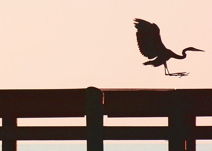
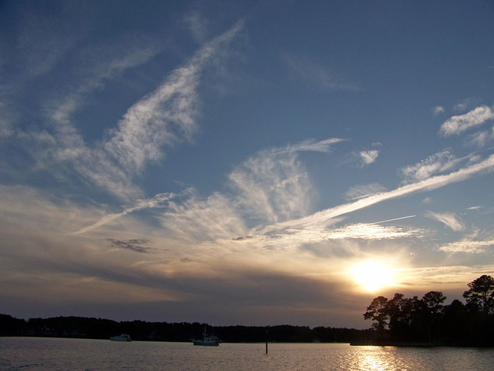
 A cormorant dries it's wings in the setting sun


